Measuring vertical distances
Vertical distances are perpendicular to the ground or earth surface. We talk usually about height or altitude. Most common methods used are listed below.
- Barometric leveling is rough method with precision about ±1 m
- Chorobates
- Plastic tube leveling
- Trigonometric leveling
- Differential leveling using level and rod
- GPS
Rough methods for vertical leveling
Most surveyors now use levels or transits. Since these instruments are costly and rarely available in rural communities of developing countries, other alternatives may be useful.
Chorobates
The Roman surveyors used chorobates. This level-transit can be made using locally available materials, wood.
Plastic tube leveling
If plastic tube is available, it will be faster than chorobates. Tubing about 6 mm diameter is probably best and normally available. The difference in elevation between of about 25 to 30 m apart can be measured.
Differential leveling using level
Level instrument with rods is more precise equipment to find heights difference. Differential leveling assumes that we know the altitude of the starting point A:
- either point A is known Benchmark point (BP) or
- we can determinate level of A from BP located nearby, or
- we establish a fix (assumption) for starting point A (e.g. we'd say for our purposes "let's assume it is at 20.000 m above sea level").
Benchmark points (BP)
It is not given that near surveyed site any benchmark point is to be found. In that case network of benchmarks will be established by surveyor. Because BP can suffer from damage, at least 3 BPs have to be established. In case of damage, based on two others, the damaged point can be re-established. Benchmarks should be established before leveling is required. Almost any fixed or permanent object can serve as BP. Sometimes nail in tree, wooden stake or clearly identified position on the pavement.
Basic leveling operation with level instrument
The figure above describes the idea of working with equipment called level. General idea should be obvious from the picture. Level instrument is set to horizontal position and has telescopic sight to make a reading of both rods.
BS and FS reading
- BS is backsight reading,
- FS is foresight reading.
Positioning the instrument
The exact location of level is not subject of a measurement and in general could be left unknown. However two rules are a common practice:
- level should be placed close to the middle point of AB to eliminate errors and
- when evaluating written protocol, HI (height of the instrument) is also computed.
There are several kinds of instruments.
- Manual is in full control of the crew. Engineer will establish proper position by means of spirit bubble.
- Self-leveling instrument has sensors monitoring spirit bubble and instrument use engine to set up its position.
- Digital is self leveling and has a built-in computer to conduct reading from rods.
Spirit bubble
Instrument is leveled into a horizontal position by means of spirit bubble. Spirit bubble is in a transparent container filled with a low viscosity liquid, e.g. alcohol or ether. The precision of bubble depends on the radius of curvature.
In general larger radius will enable better precision. If the precision is to high, bubble becomes too sensitive to any move, and it can be very time consuming to establish horizontal position and high precision might be sometimes unpractical.
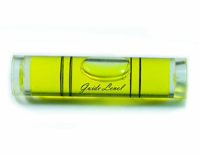
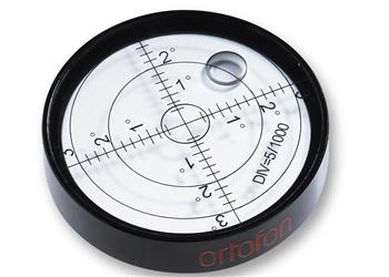


For self-leveling and digital instruments, circular bubble is built-in. Circular container is of lower precision than tubular vial, but lower precision is compensated by other internal optical components of the instrument.
Focusing telescopic sight
- In the first step point telescope to bright object (e.g. sky) and regulate eyepiece until the built-in crosshair is in sharp focus.
- With an eye focused on crosshair, regulate objective lens until destination object (rod) is sharp as well.
Running levels
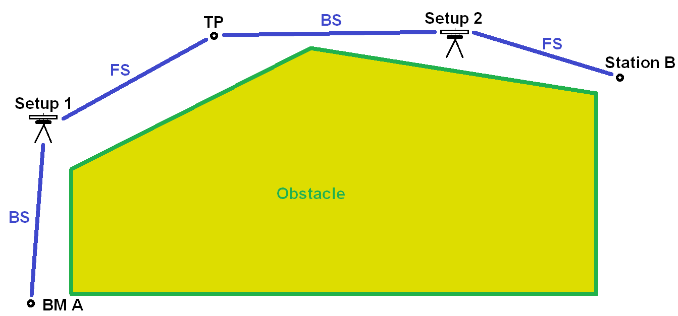
When moving over long distances, we need to move instrument and rods continuously according to points measured. We talk about turning points (TP) then. We turn the instrument over TP to the next setup.
Let's have an example: we need to take level of station B and we know coordinates of benchmark point BM A. The characteristic of terrain doesn't allow us to make a mere one setup to read BS to BM A and FS to B to find out the level of B. We have to use path around, through Setup 1 + Setup 2.
BM A is given. Station B is given and its altitude is to be found. We need a temporary station at TP: either a new station can be established at TP or it can be just a temporary position without any station.

| Station | BS | HI | FS | Elevation |
|---|---|---|---|---|
| BM A | 3.00 | 23.00 | 20.00 | |
| TP | 1.50 | 22.50 | 2.00 | 21.00 |
| B | 0.50 | 22.00 | ||
| Sum | 4.50 | 2.50 | Δ = 2.00 | |
The sum, which was found to be 2.00 m, serves to check computations above: 2.00 m has to comply with start and end point level difference.
Reciprocal leveling
It was said that setting the instrument should be done nearby center of points being measured. In that case, errors from BS and FS almost cancels each other.
Sometimes requirement of instrument's placement into middle can not be fulfilled because of obstacle, e.g. river. Reading may lead to improper evaluation of the level then.


Closing the level circuit
Measurement
- should be closed back into start point or
- should be closed into point of known elevation.
Then check of measurement can be made. Otherwise, without closing the level circuit, there is no way to detect or prevent errors and blunders. It is much less expensive to find and correct blunder in the field by closing the loop.
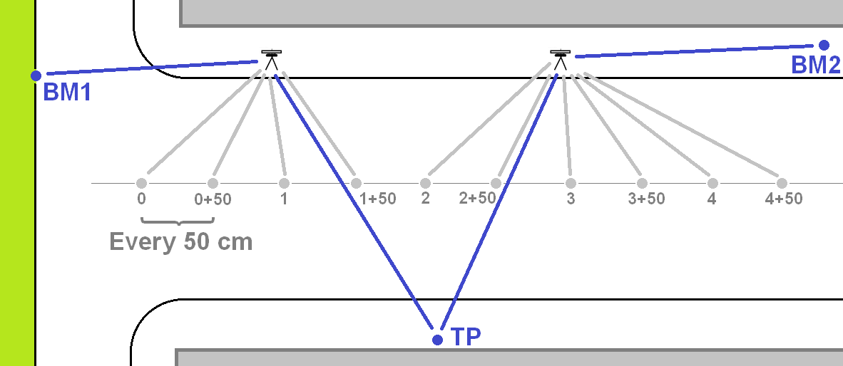
When the circuit is completed, there is usually error of closure detected. Measured levels have to be fixed for error found.
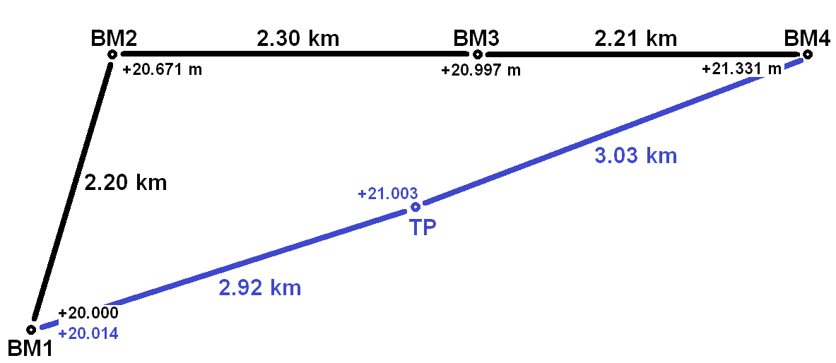

| Segment | Distance | Fix | Elev. | Elev. fixed |
|---|---|---|---|---|
| BM1-BM2 | 2.20 km | -0.002 m | +20.671 m | +20.669 m |
| BM1-BM3 | 4.50 km | -0.005 m | +20.997 m | +20.992 m |
| BM1-BM4 | 6.71 km | -0.007 m | +21.331 m | +21.324 m |
| BM1-TP | 9.74 km | -0.011 m | +21.003 m | +20.992 m |
| BM1-BM1 | 12.66 km | -0.014 m | +20.014 m | +20.000 m |
High precision leveling
Better precision can be achieved using more advanced equipment and procedure.
Procedure called three-wire leveling has long been applied for precise work. The improvement stands in crosshair, which is built into telescopic sight. Instead of the cross, there are 2 additional stadia hairs. Surveying engineer reads central value together with lower and upper. The average computed provides more accurate reading. It provides great protection against blunders as well.
The more up-to-date method is level instrument equipped with optical micrometer, which is able to move its vertical sight. The crosshair can be accurately aligned to mark on the rod then and correction from micrometer is added to the reading.
Ordinary level rods are not used for precision leveling. Instead, a precise level rod is used. It is constructed to enforce holding in a vertical position.
- Three-wire leveling
- Level instrument equipped with optical micrometer
- Used together with precise level rod
Rod shots
